GIS
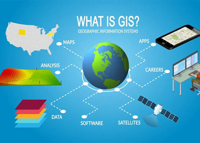
About GIS
Mapping in GIS
Mapping is a central function of Geographic Information System, which provides a visual interpretation of data. GIS store data in database and then represent it visually in a mapped format. People from different professions use map to communicate. It is not necessary to be a skilled cartographer to create maps. Google map, Bing map, Yahoo map are the best example for web based GIS mapping solution

TELECOM AND NETWORK SERVICES
GIS can be a great planning and decision making tool for telecom industries. GISDATA enables wireless telecommunication organizations to incorporate Geographic data in to the complex network design, planning, optimization, maintenance and activities. This technology allows telecom to enhance a variety of application like engineering application, customer relationship management and location based services.
GIS FOR LAND ADMINISTRATION
In a number of countries, the separate functions of land administration are being drawn together through the creation of digital cadastral databases, with these database they can reuse land for suitable needs ,digital taxation and even utilities are also easily handle using these database.
UTILITIES MAPPING
The GIS is used for different type of utilities like electricity, telecom and cooking gas on a daily basis and utilities to help them in mapping, in inventory systems, track maintenance, monitor regulatory compliance or model distribution analysis, transformer analysis and load analysis.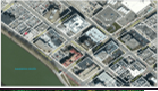
GIS BASED DIGITAL TAXATION
Using GIS we can develop a digital taxation system. In Local Governments, GIS is used to solve taxation problems. It is used to maximize the government income. For example, for engineering, building permits, city development and other municipal needs, GIS is used. Often the data collected and used by one agency or department can be used by another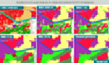
LAND INFORMATION SYSTEM
GIS based land acquisition management system will provide complete information about the land. It would help in assessment, payments for private land with owner details, tracking of land allotments and possessions identification and timely resolution of land acquisition related issues.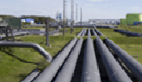
PIPELINE ROUTE SELECTION
Pipeline route planning and selection is usually a complex task. GIS technology I faster, better and more efficient in this complex task. Accurate pipeline route selection brings about risk and cost reduction as well as better decision making process. GIS least cost path analysis have been effectively used to determine suitable oil and gas pipeline routes. An optimal route will minimize reduce economic loss and negative socio-environmental impacts.
INFRASTRUCTURE DEVELOPMENT
Advancement and availability of technology has set a new mark for professionals in the infrastructure development area. Now more and more professionals are seeking help of these technologically smart and improved information systems like GIS for infrastructure development. Each and every phase of infrastructure life cycle is greatly affected and enhanced by the enrollment of GIS.
LOCATING UNDERGROUND PIPES AND CABLES
Pipe line and cable location is essential for leak detection. It can be used to understand your water network, conducting repairs and adjustments, locating leaks known distance for correlating etc. Pipelines are continually monitored, check for leak detection and avoid the problem of geo hazards.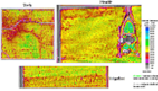
AGRICULTURAL APPLICATIONS
GIS can be used to create more effective and efficient farming techniques. It can also analyze soil data and to determine: what are the best crop to plant?, where they should go? how to maintain nutrition levels to best benefit crop to plant?. It is fully integrated and widely accepted for helping government agencies to manage programs that support farmers and protect the environment. This could increase food production in different parts of the world so the world food crisis could be avoided.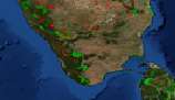
FOREST FIRE MAPPING
Forest is one of the important element of the nature. It plays an important role in the local climate. Forest fires caused extensive damage to our communities and environmental resource base. GIS can effectively use for the forest fire hazard zone mapping and also for the loss estimation. GIS also help to capture real time monitoring of fire prone areas.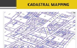
CADASTRAL MAPPING
Cadastral information give location of land parcels, define boundaries, gives sizes which are fundamental pieces of information on the issues of land allocation procedures, valuation of properties and reduction of litigation. As well the information has been used as criteria for assessing and levying land tax as well as land rent. Other notable use and advantages of cadastral information is that the owner of the land can use it as collateral in banks to acquire loans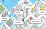
SMART CITY PLANNING
The smart city planning is to promote cities that provide core infrastructure and give a decent quality of life to its citizens, a clean and sustainable environment and application of ‘Smart’ Solutions. The focus is on sustainable and inclusive development and the idea is to look at compact areas, create a replicable model which will act like a light house to other aspiring cities.
ESTIMATION:
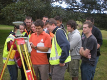
SURVEY:

Training:
We are providing customised trainning programs on
if you are Intertested? please click Contact Now 'OR' Call +91-8433132122